
How Did We Get Here?

PHASE 1
Network Concepts
Spring 2020 - Summer 2020*
In the Spring and Summer of 2020 DART led a bus network design phase where DART developed a pair of contrasting bus Network Concept choices and gathered feedback from stakeholders (including municipal partners, transit riders, employers, workers and community leaders) on how DART should make major choices in the redesign of the network.
PHASE 2
Draft New Bus Network
Fall 2020 - Spring 2021*
In Spring 2021 DART is presenting the Draft New Bus Network to the public. The Draft Network uses the same limited budget as the existing bus network, and was designed based in input from Phase I. Phase II goes through June 8.
The Draft Network would put more service in the places where the most people ride today.
PHASE 3
Final New Bus Network
Summer 2021 - Fall 2021*
After gathering input from the public, municipal stakeholders and the DART Board, a Final New Bus Network Plan will be created in Summer 2021. DART is planning to make service changes based on the Plan in January 2022.
How is the Draft Network different?
The Draft New Bus Network was drawn from a blank slate. Some routes are similar to the routes running today, but there are proposed changes to nearly every single route in the system utilizing the same limited budget.
In consideration of public input, the DART Board decided to make a modest shift to a higher ridership network.
The biggest difference, and the change that drives all of the other differences, is that the new network focuses more of DART’s bus service in the places and the routes where the most people ride.
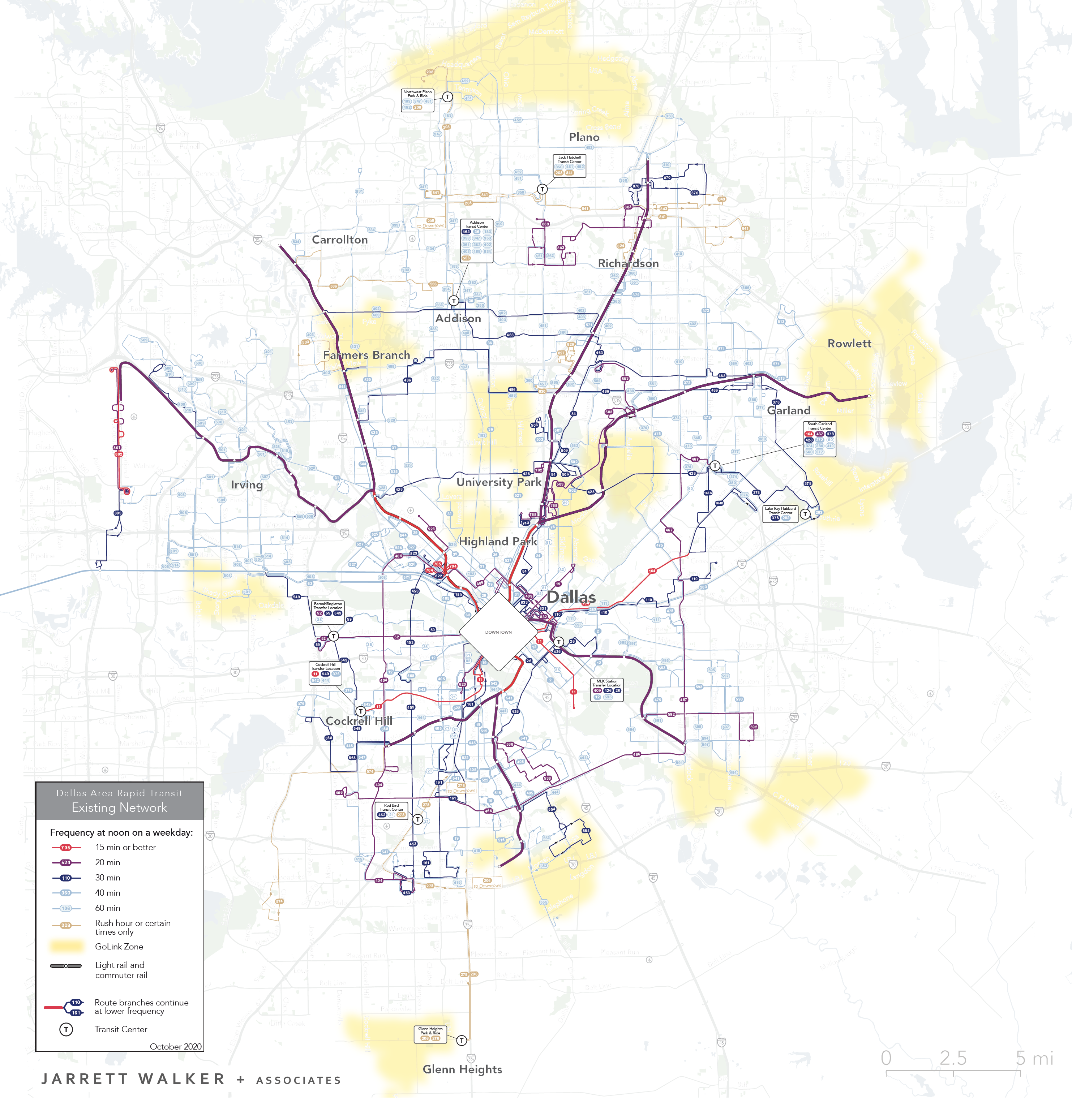
Existing Network Map
All routes in the Draft New Network have new numbers! Check what routes would be near you in the interactive map or the route-by-route guide.
* Click image to enlarge
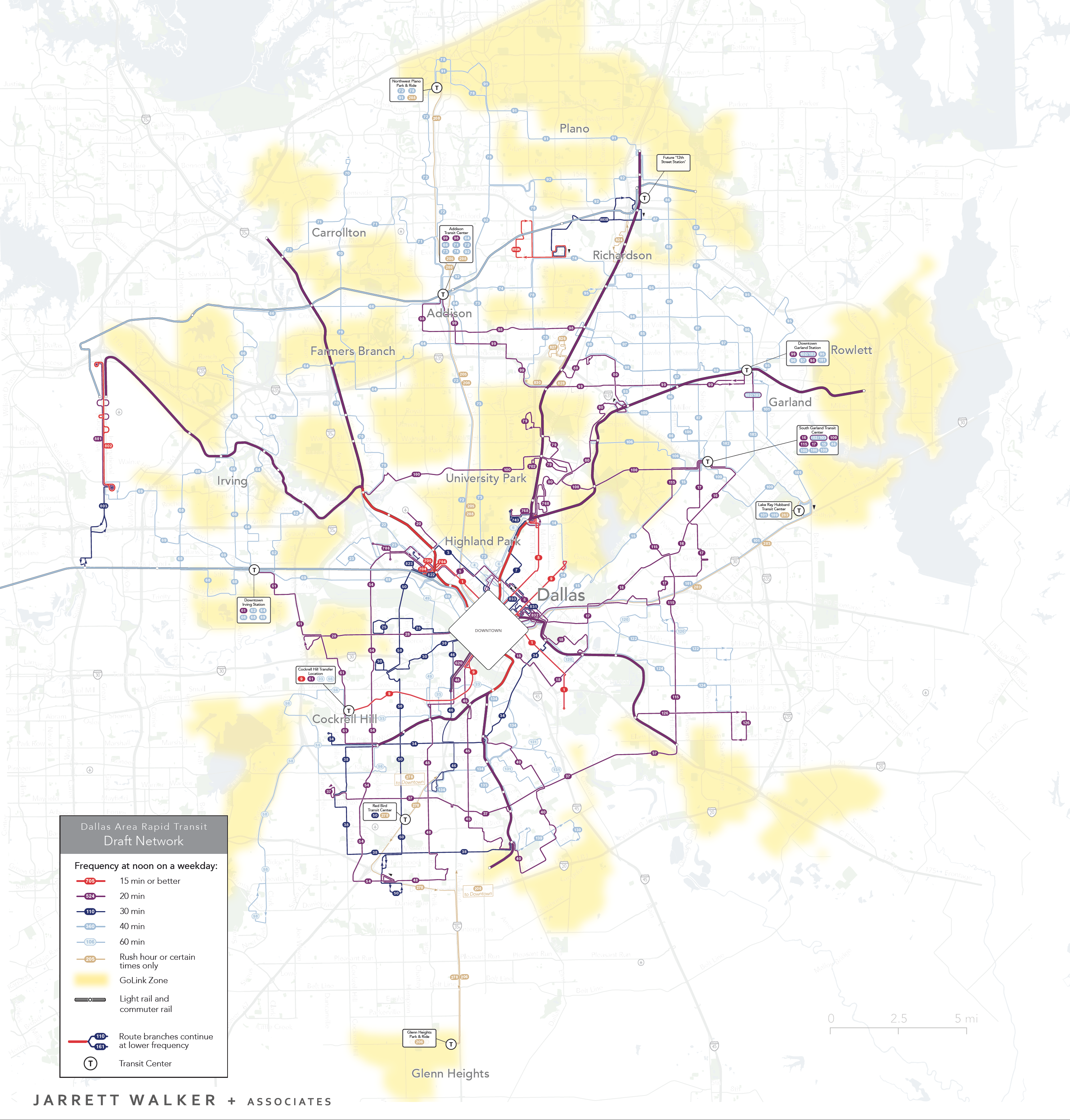
Draft New Network Map
Want to see maps of downtown Dallas, or local areas? Download the report or use the interactive map.
* Click image to enlarge
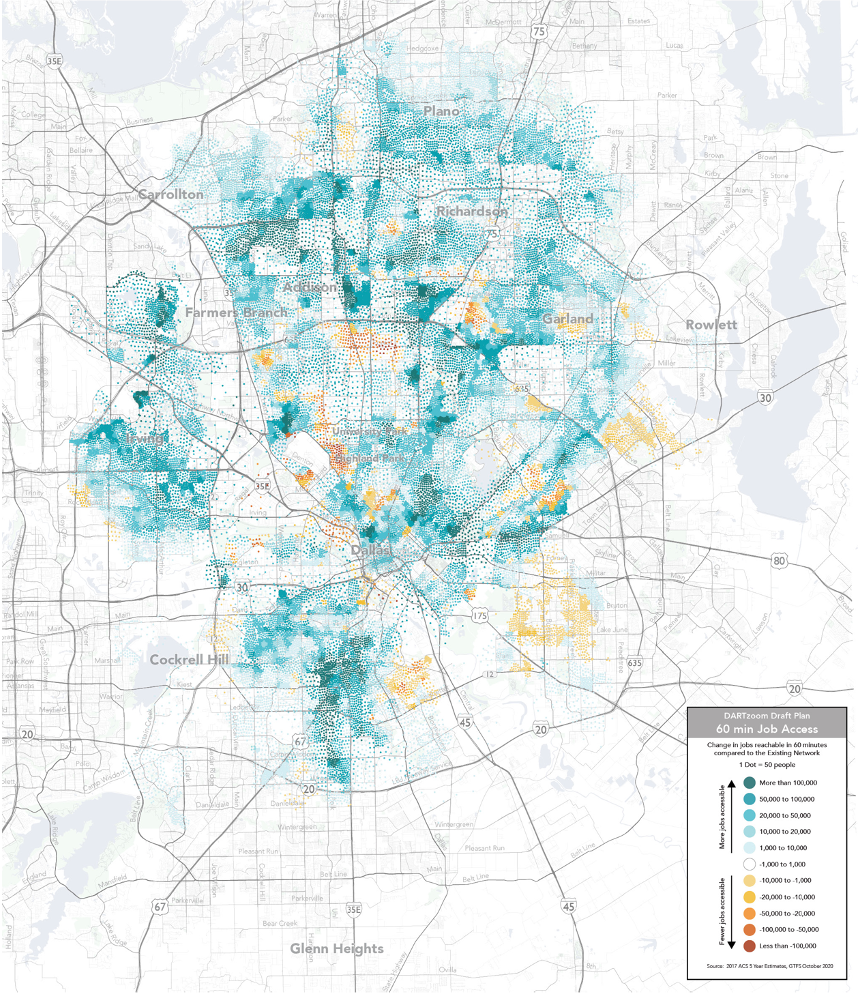
Access to Jobs in the Draft New Network
The map at right shows how residents’ job access would change.
- In most places, and for the great majority of residents, more jobs would be reachable; they are shown in shades of blue.
- In a few places, fewer jobs would be reachable; they are shown in shades of orange.
- On this map, more dots mean more people, so the more intense the color the more people experience that gain or loss.
The Draft New Network would increase job access, or shorten commutes, for most residents and riders.
To look closely at how job access would change for a place you care about, explore the interactive map.
* Click image to enlarge